
Tectonic Origins: How the Rift Was Born
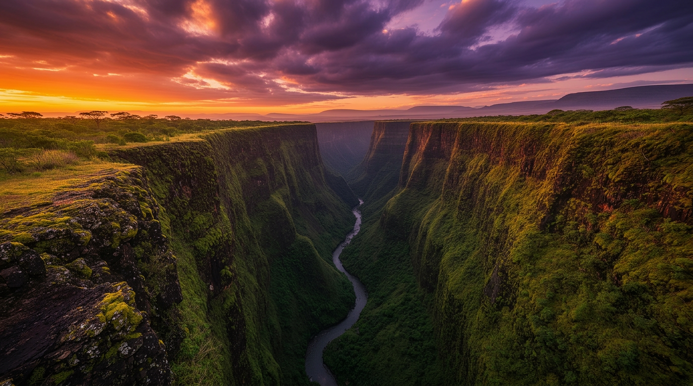
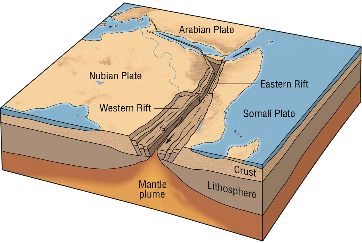
The Great Rift Valley is the surface expression of an active divergent tectonic boundary where the African Plate is splitting into two distinct plates: the Nubian Plate to the west and the Somali Plate to the east. This process, known as continental rifting, began approximately 25–30 million years ago during the Oligocene epoch and continues today at a rate of roughly 6–7 millimetres per year.
The rift system is divided into two principal branches. The Eastern Rift Valley (also called the Gregory Rift, after the geologist John Walter Gregory who explored it in 1893) runs through Ethiopia, Kenya, and Tanzania. The Western Rift Valley follows the border regions of Uganda, the Democratic Republic of the Congo, Rwanda, Burundi, and western Tanzania, forming the chain of African Great Lakes including Lakes Albert, Edward, Kivu, and Tanganyika.
Between these two arms lies the elevated East African Plateau, which supports some of the continent's most productive agricultural land and densest rainforest ecosystems. The interplay between the two rift arms has created a topographic diversity unmatched anywhere else on Earth: from the Dead Sea at 430 metres below sea level to the snow-capped peaks of Mount Kilimanjaro at 5,895 metres.
Geophysicists have identified a massive plume of superheated mantle rock — a mantle plume — beneath the East African Plateau, which is the driving force behind the rifting process. This plume has thinned the continental lithosphere, causing the crust to stretch, fracture, and subside along normal fault lines. The result is the characteristic graben — a down-dropped block of crust bordered by parallel faults — that defines the valley floor.
Key Takeaways
- •The Great Rift Valley is formed by the divergence of the Nubian and Somali tectonic plates.
- •Rifting began 25–30 million years ago and continues at ~7 mm per year.
- •The Eastern (Gregory) and Western Rift branches create two parallel troughs.
- •A deep mantle plume beneath East Africa drives the entire process.
Did You Know?
At its current rate of separation, the Somali Plate will eventually break away completely from Africa, creating a new ocean basin — a process scientists estimate will take 5–10 million years.
Volcanism and the Rift's Dramatic Landscapes
The tectonic forces that created the Rift Valley also produced one of the most volcanically active regions on the African continent. Over 30 active and semi-active volcanoes line the rift, and the region's volcanic history has sculpted some of the most recognizable landscapes in world geography.
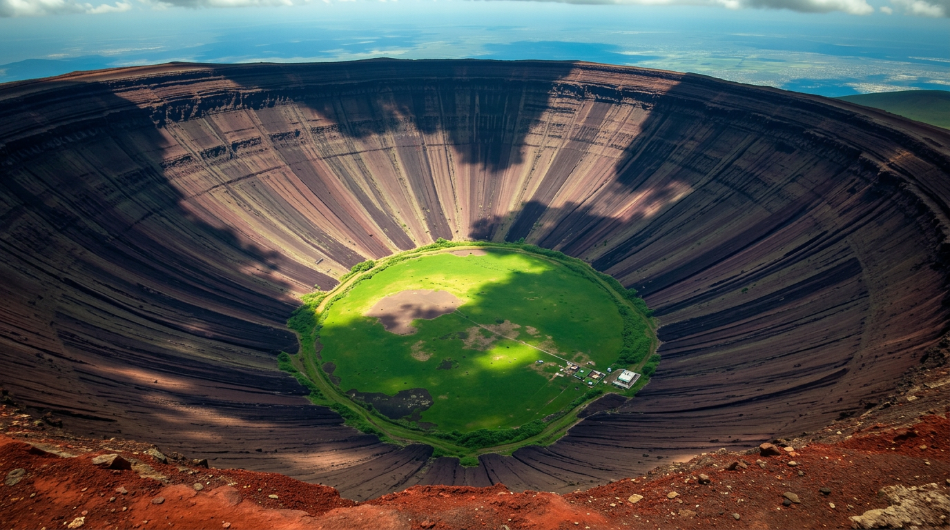
Ngorongoro Crater in northern Tanzania is the world's largest unbroken and unflooded volcanic caldera, measuring approximately 19 kilometres in diameter with walls rising 600 metres above the crater floor. Formed when a massive volcano — estimated to have been similar in size to Mount Kilimanjaro — collapsed inward roughly 2 million years ago, the crater now shelters approximately 25,000 large animals in a self-contained ecosystem. The Ngorongoro Conservation Area was inscribed as a UNESCO World Heritage Site in 1979.
Ol Doinyo Lengai in Tanzania is the only active volcano in the world that produces natrocarbonatite lava — a unique magma composition that erupts at temperatures of approximately 500°C (compared to 1,000°C or more for most silicate lavas) and turns white upon exposure to moisture. The Maasai people regard Ol Doinyo Lengai as the sacred Mountain of God.
Mount Kenya (5,199 metres), an extinct stratovolcano and Africa's second-highest peak, was formed approximately 3 million years ago by rift-related volcanism. Its three main peaks — Batian, Nelion, and Point Lenana — bear glaciers that are retreating rapidly due to climate change. The mountain is a UNESCO World Heritage Site and a Biosphere Reserve.
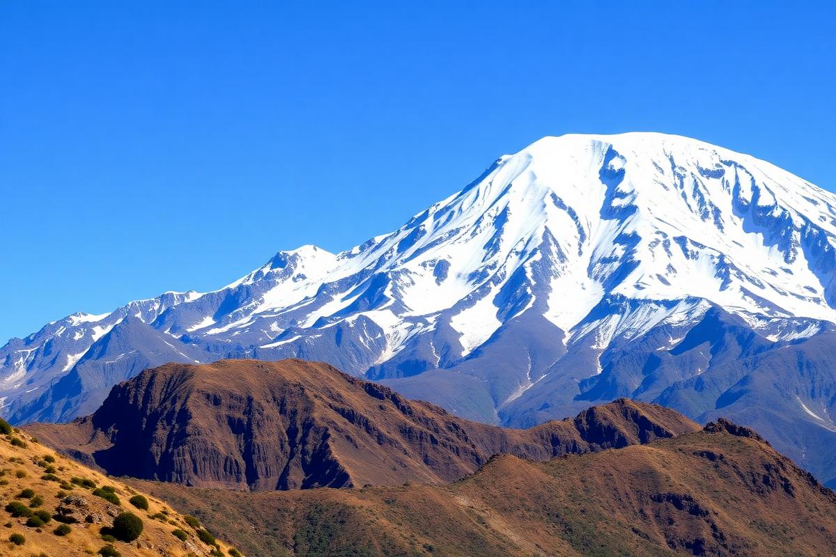
Mount Kilimanjaro (5,895 metres), while located slightly east of the main rift axis, owes its existence to the same mantle plume activity. It is the highest free-standing mountain in the world and the tallest peak in Africa, comprising three distinct volcanic cones: Kibo, Mawenzi, and Shira.
The rift's volcanic soils — particularly the rich andosols derived from volcanic ash — are among the most fertile on the continent, supporting the dense agricultural output of the Ethiopian and Kenyan highlands.
Key Volcanic Formations of the Rift
- Ngorongoro Crater
- 19 km diameter, 600 m deep
- Mount Kilimanjaro
- 5,895 m — Africa's highest
- Mount Kenya
- 5,199 m — UNESCO World Heritage
- Ol Doinyo Lengai
- Only natrocarbonatite volcano
- Mount Meru
- 4,566 m — Tanzania's 2nd highest
- Erta Ale (Ethiopia)
- Persistent lava lake since 1906
The Great Lakes: Water in the Valley
The Rift Valley's tectonic troughs have filled with water over millions of years, creating a chain of lakes that rank among the most important freshwater and alkaline water bodies on Earth. These lakes are critical to regional biodiversity, local economies, and global climate systems.
Lake Victoria, while technically not within the rift itself but occupying a shallow depression between the Eastern and Western Rift branches, is Africa's largest lake by surface area (approximately 68,800 km²) and the world's second-largest freshwater lake. It is the primary source of the Nile River and supports the livelihoods of over 30 million people across Kenya, Tanzania, and Uganda.
Lake Tanganyika, formed within the Western Rift, is the world's second-deepest lake (1,470 metres) and the longest freshwater lake (approximately 676 km). It holds an estimated 18% of the world's available surface freshwater — more than all five North American Great Lakes combined. The lake's extraordinary age (9–12 million years) has allowed for the evolution of over 350 endemic cichlid fish species, making it one of the most important sites for the study of evolutionary biology.
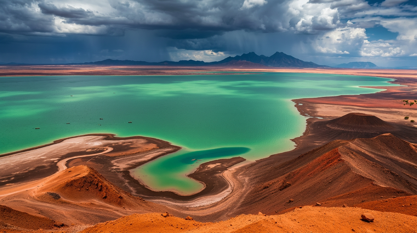
Lake Turkana in northern Kenya, known as the Jade Sea for its distinctive blue-green colour caused by algal blooms, is the world's largest permanent desert lake and the world's largest alkaline lake. The lake and its surrounding sedimentary deposits have yielded some of the most important hominin fossils ever discovered, including Turkana Boy (Homo erectus, approximately 1.5 million years old) and Kenyanthropus platyops (3.5 million years old). The Lake Turkana region was designated a UNESCO World Heritage Site in 1997.
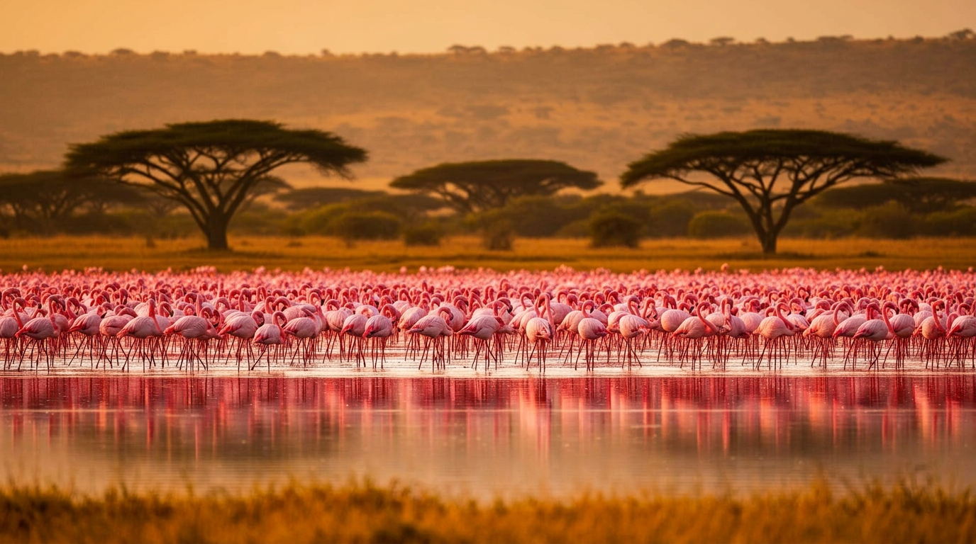
Lake Nakuru in Kenya's Central Rift Valley is one of the Rift Valley soda lakes — shallow, alkaline water bodies that support massive colonies of cyanobacteria and the lesser flamingos that feed on them. At peak concentrations, Lake Nakuru has hosted an estimated 1.5 million flamingos simultaneously, creating one of the natural world's most photographed spectacles.
Other notable rift lakes include Lake Bogoria (famous for its geysers and flamingos), Lake Baringo (one of only two freshwater rift lakes in Kenya), Lake Naivasha (an important floriculture hub), and the chain of Ethiopian Rift Valley lakes including Ziway, Langano, Abijatta, and Shala.
Key Takeaways
- •Lake Tanganyika holds 18% of the world's surface freshwater.
- •Lake Turkana is the world's largest permanent desert lake and a cradle of hominin fossils.
- •Lake Nakuru has hosted up to 1.5 million flamingos simultaneously.
- •Lake Victoria is Africa's largest lake and the primary source of the Nile.
Ready to plan your East Africa trip?
Let our experts craft your perfect itinerary based on your interests.
The Cradle of Humanity: Paleoanthropology in the Rift
No geological feature on Earth has contributed more to our understanding of human origins than the Great Rift Valley. The valley's tectonic activity, combined with its sedimentary environments and volcanic ash deposits that enable precise radiometric dating, has preserved a fossil record spanning over 6 million years of hominin evolution.
Olduvai Gorge (Oldupai Gorge in Maasai), a 48-kilometre ravine in Tanzania's Ngorongoro Conservation Area, is one of the most important paleoanthropological sites in the world. It was here that Louis and Mary Leakey discovered remains of Homo habilis (approximately 1.8 million years old), establishing the genus Homo in East Africa. The gorge has yielded fossils spanning nearly 2 million years of continuous occupation, along with stone tools from the Oldowan tradition — the earliest known stone tool technology.
Laetoli, located 45 kilometres south of Olduvai Gorge, preserves a trail of fossilized hominin footprints dating to approximately 3.66 million years ago. Discovered by Mary Leakey's team in 1978, these footprints — made in freshly fallen volcanic ash from the nearby Sadiman volcano — provide the earliest direct evidence of bipedal locomotion in our hominin ancestors (attributed to Australopithecus afarensis).
The Turkana Basin in Kenya has produced an extraordinary concentration of hominin fossils. Richard Leakey's expeditions to the eastern shores of Lake Turkana (Koobi Fora) yielded KNM-ER 1470, a Homo rudolfensis cranium dated to approximately 1.9 million years ago. The western shore site of Nariokotome produced Turkana Boy (KNM-WT 15000), a remarkably complete Homo erectus skeleton of a juvenile male dated to approximately 1.5 million years ago — the most complete early human skeleton ever found at that time.
The Afar Triangle in Ethiopia — where the rift branches into a triple junction — has produced the famous Australopithecus afarensis skeleton known as Lucy (3.2 million years old), discovered by Donald Johanson in 1974 at Hadar. More recently, the Middle Awash region has yielded Ardipithecus ramidus (4.4 million years old), pushing back the known record of bipedal hominins.
The significance of these discoveries cannot be overstated: the Rift Valley fossil record demonstrates that Africa — specifically the East African Rift System — is the evolutionary homeland of our entire species.
Did You Know?
The footprints preserved at Laetoli in Tanzania, dating to 3.66 million years ago, show that our ancestors walked upright more than 1.5 million years before the first stone tools appear in the archaeological record.
Key Fossil Discovery Sites
- Olduvai Gorge, Tanzania
- Homo habilis, 1.8 Ma
- Laetoli, Tanzania
- Bipedal footprints, 3.66 Ma
- Koobi Fora, Kenya
- Homo rudolfensis, 1.9 Ma
- Nariokotome, Kenya
- Turkana Boy (H. erectus), 1.5 Ma
- Hadar, Ethiopia
- Lucy (A. afarensis), 3.2 Ma
- Middle Awash, Ethiopia
- Ardi (A. ramidus), 4.4 Ma
Wildlife Corridors: The Rift as an Ecological Highway
The Great Rift Valley functions as a continental-scale ecological corridor, channelling the movements of wildlife and shaping the distribution of species across eastern Africa. The valley's topographic variation — from below sea level to mountain peaks above 5,000 metres — creates an extraordinary range of habitats within relatively short distances.
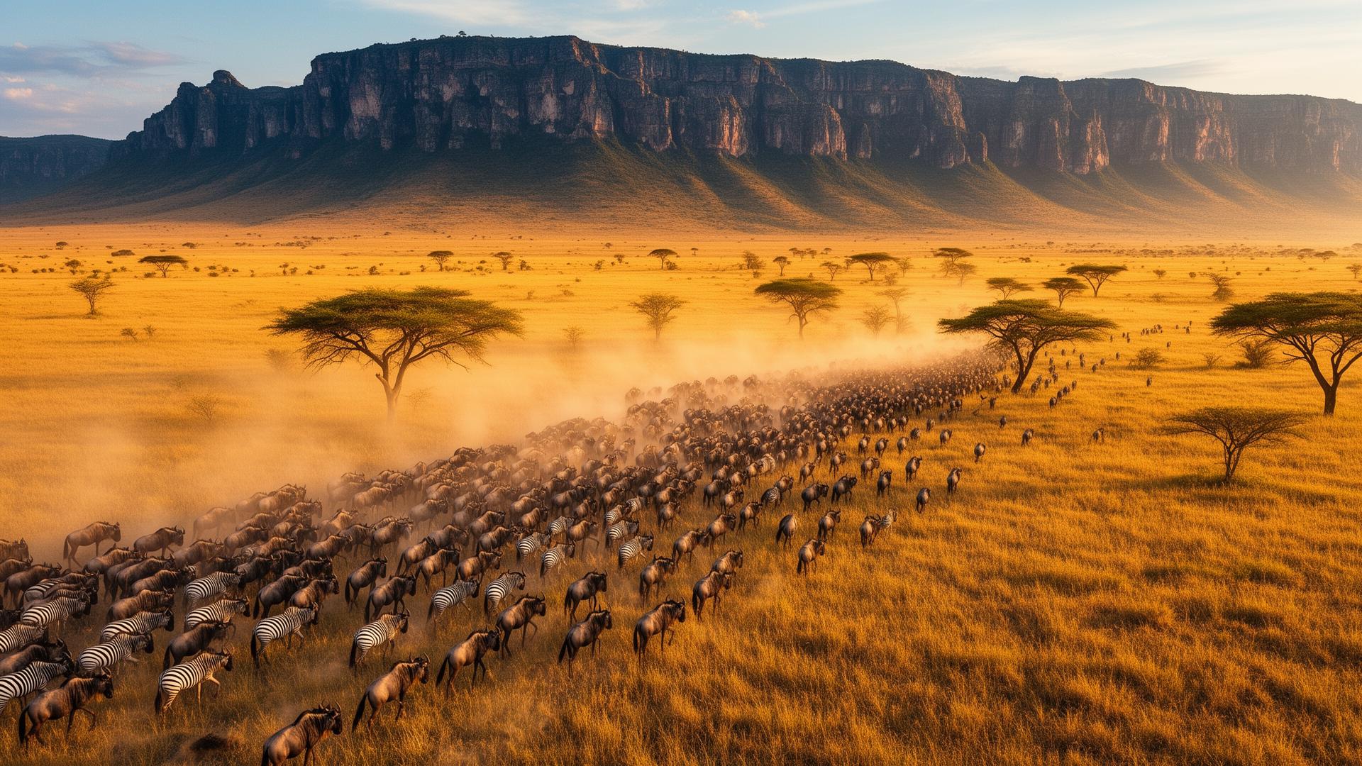
The Great Migration of the Serengeti-Mara ecosystem — involving approximately 1.5 million wildebeest, 500,000 zebras, and 200,000 Thomson's gazelles — follows a broadly circular route that is influenced by the rift's topography and the rainfall patterns it generates. The rift escarpments create orographic effects that concentrate rainfall in specific areas and seasons, driving the grasses that sustain the migratory herds.
The Albertine Rift (the section of the Western Rift running through Uganda, Rwanda, and the eastern DRC) is one of the most biodiverse regions in Africa. It contains more endemic mammal, bird, reptile, and amphibian species than any other region on the continent. Bwindi Impenetrable Forest National Park, perched on the western rift escarpment in Uganda, shelters approximately half of the world's surviving mountain gorilla population (estimated at 459 individuals in Bwindi out of a global total of approximately 1,063).
The rift lakes serve as critical stopover points on the Rift Valley Flyway, one of the world's major bird migration routes connecting breeding grounds in Europe and Asia with wintering areas in Africa. Lakes Nakuru, Bogoria, and Natron in the Eastern Rift support breeding colonies of lesser and greater flamingos, while Lake Baringo hosts over 450 recorded bird species.
The Ethiopian Highlands, uplifted by the rift's tectonic activity, harbour endemic species found nowhere else on Earth, including the Ethiopian wolf (Canis simensis, the world's rarest canid with fewer than 500 individuals) and the Gelada baboon (Theropithecus gelada), the only grass-eating primate.
Key Takeaways
- •The Great Migration involves 1.5 million wildebeest and follows rift-shaped rainfall patterns.
- •The Albertine Rift is Africa's most biodiverse region for endemic species.
- •Bwindi Impenetrable Forest shelters ~459 mountain gorillas — nearly half the global population.
- •The Rift Valley Flyway is a critical intercontinental bird migration route.
Civilizations of the Valley: From Pastoral Empires to Modern Nations
Beyond its geological and paleoanthropological significance, the Great Rift Valley has shaped the development of human civilizations for millennia. The valley's diverse environments — from fertile highlands to semi-arid lowlands — have supported a remarkable range of human adaptive strategies.
The Maasai (Maa-speaking peoples) are among the most recognizable cultural groups associated with the Rift Valley. Inhabiting the rift floor and escarpment areas of southern Kenya and northern Tanzania, the Maasai have maintained a semi-nomadic pastoralist lifestyle centred on cattle herding for centuries. Their territorial range — from Laikipia in the north to the Ngorongoro Highlands in the south — closely follows the Eastern Rift's grassland corridors.
The Ethiopian Rift Valley has been a corridor of human movement and cultural exchange for millennia. The Omo Valley in southern Ethiopia is home to some of the world's most culturally diverse communities, including the Mursi, Hamar, and Karo peoples. Their elaborate body painting, lip plates, and bull-jumping ceremonies represent some of the oldest continuous cultural traditions in Africa.
The Swahili Civilization, while centred on the Indian Ocean coast, was deeply connected to the Rift Valley through trade networks. The caravan routes that brought ivory, gold, and enslaved peoples from the East African interior to the coast — and returned with textiles, glass beads, and metalwork — often followed the Rift Valley's natural corridors.
In the modern era, the Rift Valley continues to shape the political and economic geography of East Africa. Kenya's Rift Valley Province (now divided into several counties) is the country's largest and most agriculturally productive region. The geothermal energy potential of the rift — Kenya's Olkaria Geothermal Complex in the Rift Valley is one of the largest in Africa — represents a major renewable energy resource.
Did You Know?
Kenya generates approximately 47% of its electricity from geothermal sources in the Rift Valley, making it one of the top geothermal energy producers in the world and the leading producer in Africa.
Ready to plan your East Africa trip?
Let our experts craft your perfect itinerary based on your interests.
Conservation and the Future of the Rift
The Great Rift Valley faces a complex matrix of conservation challenges in the 21st century. Population growth, agricultural expansion, industrialization, and climate change are placing unprecedented pressure on the rift's ecosystems.
Lake Turkana is threatened by the Gibe III Dam on Ethiopia's Omo River, which controls approximately 90% of the lake's inflow. The dam has significantly altered the river's seasonal flood patterns, threatening the livelihoods of approximately 300,000 pastoralists who depend on the lake and its flood-retreat agricultural systems. The lake's water level dropped by approximately 1.5 metres in the years following the dam's completion in 2015, and scientists warn of further declines.
The Serengeti-Mara ecosystem faces pressure from proposed infrastructure developments, including roads and railways that could bisect wildlife migration corridors. Conservation organizations and the Tanzanian and Kenyan governments have engaged in ongoing negotiations to balance development needs with ecosystem integrity.
Climate change is accelerating glacial retreat on Mount Kenya, Mount Kilimanjaro, and the Rwenzori Mountains. The Lewis Glacier on Mount Kenya, which covered approximately 0.4 km² in 1934, has lost more than 90% of its area. These glaciers serve as critical water towers for millions of people downstream.
However, conservation successes offer grounds for optimism. Mountain gorilla populations in the Albertine Rift have increased from approximately 620 individuals in 1989 to over 1,063 today — a rare conservation success story driven by coordinated efforts between Rwanda, Uganda, and the Democratic Republic of the Congo. Community conservancies in Kenya's Rift Valley, such as the Northern Rangelands Trust, have demonstrated that wildlife conservation can be compatible with pastoralist livelihoods.
The Great Rift Valley remains one of the most scientifically important and ecologically valuable regions on Earth. Its continued study and conservation are essential — not only for the people and wildlife that depend on it today, but for the understanding of our shared origins as a species.
Key Takeaways
- •Mountain gorilla populations have increased from 620 to over 1,063 since 1989.
- •Kenya generates ~47% of electricity from Rift Valley geothermal sources.
- •Mount Kenya's Lewis Glacier has lost over 90% of its area since 1934.
- •Community conservancies demonstrate compatibility between wildlife and pastoralist livelihoods.
Experiencing the Rift Valley: A Traveller's Guide
The Great Rift Valley offers some of the most diverse and rewarding travel experiences in Africa. Whether your interest lies in geological wonders, wildlife encounters, or cultural immersion, the rift delivers experiences that are difficult to match anywhere else on Earth.
Kenya's Rift Valley
The Kenyan section is perhaps the most accessible for first-time visitors. The Rift Valley viewpoint on the Nairobi-Naivasha road offers dramatic panoramic views of the escarpment. Lake Naivasha provides boat safaris and birdwatching, while Lake Nakuru National Park delivers reliable flamingo sightings and rhino encounters. Hell's Gate National Park offers the unique opportunity to walk and cycle among wildlife, with dramatic gorges and geothermal features.Tanzania's Rift Highlights
The Ngorongoro Crater delivers one of Africa's most concentrated wildlife viewing experiences, with the Big Five reliably present within the crater's 260 km² floor. Olduvai Gorge Museum provides essential context for the region's paleoanthropological significance. Lake Natron, a remote alkaline lake near the Kenyan border, is the primary breeding site for East Africa's 2.5 million lesser flamingos.Ethiopia's Rift Valley
The Danakil Depression — the hottest inhabited place on Earth — offers otherworldly landscapes of sulphur springs, salt flats, and the Erta Ale lava lake. The Omo Valley provides culturally rich encounters with indigenous communities. The Ethiopian Rift Valley lakes (Ziway, Langano, Hawassa) are increasingly popular for birdwatching and relaxation.Uganda and Rwanda
The Albertine Rift offers gorilla trekking in Bwindi and Volcanoes National Park, chimpanzee tracking in Kibale Forest, and the dramatic Rwenzori Mountains — the legendary "Mountains of the Moon."Best Rift Valley Experiences by Country
- Kenya
- Lake Nakuru, Hell's Gate, Naivasha
- Tanzania
- Ngorongoro, Olduvai, Lake Natron
- Ethiopia
- Danakil, Omo Valley, Rift Lakes
- Uganda
- Bwindi, Rwenzoris, Kibale Forest
- Rwanda
- Volcanoes NP, Lake Kivu
- Best Season
- Jun–Oct (dry) or Jan–Mar